 |
| Stage 3b |
Stage Three 17 – 24 January 2009
Day 14 – St Arnaud to Speargrass Hut
After a week back in Christchurch my leg was fully healed. I spent the week at work, armed myself with anti-histamine tablets and bought a bus ticket for Kawatiri Junction leaving early Saturday morning. I wasn’t going to miss this bus so I was at the bus stop well before time. The forecast for this week was rain to begin and then becoming fine.
It was raining while travelling over Lewis Pass but dry again when the bus stopped for a break in Murchison. I got off the Nelson-bound bus at Kawatiri Junction 25 km short of St Arnaud. I walked a fair way up the road before the first vehicle came past. Fortunately the guy stopped and gave me a ride into St Arnaud. I started walking from Kerr Bay at 2pm heading up the ski field road and then onto the track to Speargrass Hut. This was a more direct route than the official Te Araroa route, which goes up the Travers valley. I decided to go this way as I had been over Travers Pass before and with forecasted poor weather this way would be more sheltered. It started to rain while I was still on the ski field road. I took a short break at the roadend shelter to change into my boots before carrying on to the hut to arrive there soaking wet at 5pm.
 |
| Speargrass Hut |
Day 15 – Speargrass Hut to Blue Lake Hut
I shared the hut with two others who were heading the opposite way. I left early the next morning and the weather stayed dry until I reached Sabine Hut. It began to rain while I was having a meal break in the hut and then stopped just as I left the hut at 10.30am. I was mindful of any wasps about as they can be found in good numbers in beech forests. It soon started to rain again, which was good in one way as seemed to suppress the number of wasps. Along the track to West Sabine Hut there were plenty of trampers coming the other way many with unsuitable clothing for the conditions. I took another break at the hut before heading out into what was now cold rain. I tramped quickly doing the stretch up to Blue Lake Hut in little over two hours. Along the way I had passed a group of trampers who were taking a break under an overhanging rock. They were five of the six people I shared the hut with that night. There was a sprinkling of snow forming on the surrounding tops and it was nice that the tramper already in residence at the hut had the fire going.
 |
| Lake Rotorua |
 |
| Blue Lake |
Day 16 – Blue Lake Hut to Lake Guyon Hut
The next morning the weather was still showery. None of the others were making any attempt to get going as I left the hut. They were all planning to also cross Waiau Pass but then head to Lake Thompson. I arrived at the pass at 10.30am wearing fleece top, raincoat, beanie and gloves for warmth in the wintry conditions. I quickly descended to the Waiau forks, stopping for a meal break before continuing on to Caroline Biv. A large mob of the St James wild horses were grazing nearby. I stopped to prepare and eat my standard lunch food, hot soup with pita breads filled with cheese and salami. The weather had improved somewhat as I left the biv just before 4 heading along the river flats for Lake Guyon Hut. The going is fairly easy but it is a long way so I had sore feet by the time I turned off the river flats a little after 7pm to head along the half hour detour to the hut. The middle-aged couple that were residence in the Lake Guyon Hut got a bit of a fright as I went to push open the hut door, one of them had been snoozing in a chair against the inside of the door.
 |
| Lake Constance |
 |
| Mob of horses by Waiau River |
Day 17 – Lake Guyon Hut to Boyle River Settlement
I was tramping again by 7am the next morning. Initially feeling fresh as I passed by the Ada Homestead to cross over the flats to get on to the St James Walkway. The flats surrounding the homestead were in the process of being fenced off. St James Station had just recently been bought by the government for the land to be become part of the conservation estate but St James owners were being allowed to keep the homesteads with a generous area of surrounding flat paddocks. Along the track to Anne Hut I came across a large mob of wild pigs, three or four adults with a large number of young. After a break, eating soup and pita bread at Anne Hut, I headed over Anne’s Pass to Boyle Flats Hut for more soup and pita bread. Leaving the hut after 4pm in the afternoon I was starting to feel tired but still decided at the swing bridge to make the detour to check out Magdalen Hut. There was a young guy asleep in the hut with the fire going in the woodstove on what was a warm afternoon. I am not sure he enjoyed being woken up. I crossed over the Boyle River looking to join up with the track running somewhere along the other side. It took more effort then I really wanted. I finally arrived in the Boyle River Settlement at quarter to eight. A work colleague, Russell owns a bach there, which I had arranged to use. After dropping my pack at the bach I went and visited Bill, a permanent resident, who has one of only three phones in the settlement to check in with Corina. After a bit of a chat with Bill, it was now getting late. I went back to the bach for a meal and a lukewarm shower. During my shower the power went out and I was left stumbling around in the dark looking for my torch.
 |
| Lake Guyon Hut |
 |
| The yet to be burnt down Anne Hut on the St James Walkway |
Day 18 – Boyle River Settlement to Hurunui Hut
The next morning the power was still out when I left the bach for the 11 km walk along the highway to Windy Point. I stopped there at the shelter to change from wearing running shoes to tramping boots and to have a bite to eat. It was a pleasant day as I walked onto Hope Kiwi Hut arriving 2.30pm. A Lithuanian guy and his Australian girlfriend were also taking a break at the hut. They told me their story where they had got off the plane at Christchurch Airport and immediately began hitching inland. As they had arrived from overseas they needed to purchase a gas canister for their cooking stove. Looking at their map they thought they should be able to purchase one in Cass before heading off to do the Cass and Lagoon Saddles track. They found out that Cass with its population of one does not have gas canisters for sale. After completing that track they arrived in Arthur’s Pass to find they could not buy one there either. They then carried on to do the Harpers Pass route living off Weetbix and cold powdered milk. One of their questions for me was, ‘would there be a store that sells gas canisters in Hanmer Springs?’
I left them to head over Kiwi Saddle on a warm afternoon to Lake Sumner. From the head of the lake, DOC had recently realigned the track to stay in the forest. I began to follow this track for a while but I became annoyed as it meandered its way around up and down various terraces through the trees. I was in no mood for this after a long day walking so turned left off the track and headed for the grass flats running parallel to the track less than a couple of hundred metres away. Hurunui Hut could be seen off in the distance so I headed diagonally across the flats aiming straight for the hut, plunging waist deep through the Hurunui River on the way before heading up the short bush track to arrive at the hut at what was becoming a regular finishing time of quarter to eight. Three others were staying at the hut. One left for a spot of fishing at dusk and came back well after everyone else was off to bed. Over breakfast we all got the story about the catching of two large trout.
 |
| Hope Kiwi Hut |
 |
| Hurunui Hut |
Day 19 – Hurunui Hut to Locke Stream Hut
I left the next morning not long after 7am. I passed No3 Hut and Harper Biv before crossing the pass and arriving at Locke Stream Hut at a little after 3pm. With the earliest finish of the trip I used the afternoon to have a dip in the river, clean and dry the wet clothes from earlier in the trip and read through the hut book. There were a lot of mentions made in the hut book of the difficulty people had with my intended route for the next day, Minchin Pass. I used the hut radio to check the weather forecast. It was promising to be good.
 |
Hurunui Valley looking towards Harper Pass
 |
| Upper Taramakau Valley |
|
Day 20 – Locke Stream Hut to Casey Hut
For the first time on this trip I had the hut to myself. I left before 7am and travelled an hour downstream to find Townsend Creek. The trip up the gorge and finding the right fork to follow went ok. The marked track on the true left only needs to be followed until it returns to the creek. I did search out for trails through the bush away from the streambed a bit more than I needed to. I arrived at Minchin Biv around noon and enjoyed a meal break before heading further down past Lake Minchin to Poulter Hut for another break. Even though it was now warm weather I was craving soup a fair bit on this trip. The last bit of the day was an easy stroll down the Poulter River to Casey Hut. I arrived at 6pm to find four DOC workers based there. They were working on protection of the orange-fronted parakeets. Being a warm day, I enjoyed a refreshing dip in the Casey Stream running nearby.
 |
| Minchin Biv, DOC have been promising for the last few years to replace this with a 4-bunk hut |
Day 21 – Casey Hut to Cass turn-off
I was underway before 7am in the morning heading over Casey Saddle on what was becoming another warm day. After crossing Hallelujah Flats I decided to follow Andrews Stream down through its gorge rather than the marked track, which sidles high on the true left. It turned out to be a good choice, the route had been recently recut and it was pleasant going on a nice morning. I arrived at Andrews Shelter a little after 11 and changed into running shoes for the one-hour walk along the gravel road to Mount White Bridge and the highway. I had almost walked down to the start of the Cass track before a guy driving a van stopped to pick me up. The guy who lives on the West Coast was on his way to Kaiapoi to pick up his daughter. He normally didn’t stop for hitchhikers but he felt sorry for me out there on what was now a hot day. After crossing the bridge at the Waimak Gorge he dropped me in the centre of Kaiapoi. After a few calls on the cell phone I finally got hold of Sam to come and pick me up. I bought an iceblock to eat while I waited on the side of the road for him to arrive and the one thing I noticed most was the noise about the place after a week of relative quiet in the bush. Later on that evening I hopped on the scales to find I had managed to lose five kilos of bodyweight over the week.
 |
| Casey Saddle |
 |
| Gorge route on Andrews Stream |
 |
| Stage 4 |
Stage Four 5 – 9 January 2010
Day 22 – Cass to Lake Catherine
A year later, it was time to kick off the Te Araroa journey again. This section included the big rivers, the Rakaia that was not going to be crossable on foot and the Rangitata that would need ideal conditions to cross. Corina had a job interview scheduled for Wednesday 6th so it made it difficult to get underway. In the end, I got Corina to drop me off at Cass on Tuesday morning and arranged that our friend, Eric would bring her out in our car on Thursday morning to whatever side of the Rakaia I had got to. In fine conditions I left just before 10am from the Cass River road bridge, the point where I had been picked up from last summer. I crossed over Cass Saddle and arrived at Hamilton Hut at 2pm. After a meal break at the hut I headed down the Harper River passing the Pinnacles along the way. At the spot called Redoubt I climbed up to a farm track that leads through to Lake Catherine arriving at a small hut at the south end of the lake a little before 6pm.
 |
| Pinnacles |
 |
| Hut by Lake Catherine |
Day 23 - Lake Catherine to Glenrock Stream
After staying the night at the hut I left at 7am and decided to travel across country to Lake Ida. I was curious to see this lake, as I had heard the stories about Corina’s childhood trips up there to go ice-skating. It didn’t take long to get to the lake and find the old ice-skating lodge amongst the trees. The place looked derelict as I opened a sliding door to find inside one of the rooms all the hire skates and little trolleys used for pushing young kids around the ice. From Lake Ida there is a nicely graded gravel road out to its junction with the Harper Road. From there it was a long trudge along gravel roads to Lake Coleridge Village which I arrived to at 1.30pm. Along the way, the northwesterly wind was building in strength. I walked down one of the access roads to the Rakaia River and quickly realised no one was going to be boating on the river today with the dust clouds being whipped up by the wind. I took a lunch break there before heading back into the village. Without having to wait I managed to hitch a car ride down to the highway. A second ride got me over the Rakaia Gorge Bridge to the start of Blackford Road. I called Corina on the cell phone to let her know I was now heading up the south side of the river. There was no traffic coming along this road and I had walked a few km to where I was about to nip up to a house to ask for some drinking water when a car came in sight. I got a ride from Charlie Ensor who used to farm in the area. He was now retired and living in Moteuka but was back here to give his son a hand for a while. He knew a lot about this area, his grandfather had started the family farming up here and now there are a string of farms owned by cousins and one by his son. He took me up to where Glenrock Stream came down to the road. I found a good flat spot a short way up along side the stream to set up my recently acquired one-person tent. The site was sheltered nicely behind a row of trees as the wind was now up to galeforce and then it began to rain during the night.
 |
| Raikaia in a typical northwester |
 |
| Sheltered camping spot near Glenrock Stream |
Day 24 - Glenrock Stream to Comyns Hut
There was little need to get up early, as I had to wait for Corina to arrive so I lay there reading while it continued to rain. Eventually I got up and walked a couple of kilometres back down the road to a shelter belt where I could sit out of the rain and see when the car came up the road. I didn’t have to wait too long before they turned up. After a hot drink, there was a bit of sorting out of gear in which Corina realised she had left her gaiters behind. Eric left around 11am and we began the walk up the farm track to Turtons Saddle. The rain began to ease as we headed down the other side. We stopped at the A-Frame Hut for a lunch break.
Upon leaving the hut we started to find a flooded Turtons Stream. The poled route came to a point where it crossed over to the true right. The stream was braided into three there, so we chose to cross it. Even then it was a deep crossing with the first channel being hip deep. Further down the poles recrossed but realising it wouldn't be prudent to recross we continued down on the true right having to climb high above a gorge to make Comyns Hut at 4pm. The hut sits in an exposed spot; fine dust filters through the walls and covers everything inside. We stayed the night there, with quite windy conditions during the evening. Corina found a pair of old thick socks in the hut, which we adapted into a pair of gaiters.
 |
| On Turtons Saddle with a full Rakaia River below |
 |
| Climbing high to avoid a flooded Turtons Stream |
Day 25 – Comyns Hut to Double Hut
The next morning we left before 8am and headed along the recently poled route up Round Hill Creek. The stream was still running high and discoloured from the rain of the day before. We reached the saddle at 11.30am and dropped into the headwaters of the Swin River where we spotted a mob of deer. After a lunch break along side the river we carried on down on easy river flats which in contrast to the other side were not set out with marker poles. The flats become increasingly covered in matagouri. We picked up marker poles further down that led away from the river to Double Hut arriving before 3pm. We spent a relaxing afternoon, sunbathing and reading.
 |
| Clent Hills Saddle, just around the corner was a large mob of deer |
 |
| Double Hut |
Day 26 – Double Hut to Potts River confluence
The following morning we left just after 8am to head cross-country to Lake Heron. We then began the road walk towards Hakatere. After a few km I encouraged Corina to hitch a ride to the road junction. I little while after Corina had caught a ride, I then realised our intended route turned off the road up a farm track couple km before this junction but it wasn’t hard to get a message to Corina because there were a number of people who stopped to ask if I needed a ride. I met Corina coming the other way almost exactly at the turn-off.
After a brief chat we decided to stick with the road route via Lake Clearwater out to Potts River. We stopped at the old school in Harateke for a lengthy lunch break before setting off at 2.30pm for Lake Clearwater in what were initially warm and fine conditions. After a while, Corina hitched a ride to Lake Clearwater to wait for me there. Not long after a strong head wind started blowing and clouds started to build up. On arriving at Lake Clearwater we began straightaway walking the further 9 km of road to the Potts River Bridge near where it runs into the Rangitata. We arrived a little after 6pm and set up the one-person tent under some willow trees. I was feeling shattered from the walk so after cooking a meal we squeezed into our little tent. Not long after dark, a 4WD turned up and began roaring around the river flats using a shotgun to presumably shoot at rabbits. We lay there in the tent hoping they stayed far enough away to not have stray pellets come our way. Around 1am in the morning they finally left and at 2am it began to rain. Getting up in the morning it was still pissing down. I made breakfast out in the rain passing Corina her breakfast while she stayed in the tent. After we packed up we had a look across the Rangitata from the Potts River road bridge. We quickly decided that the Rangitata could not be safely crossed so began trudging back towards Lake Clearwater. About a kilometre short of Lake Clearwater, Max, an American tourist came by in his ‘Wicked Camper’. Initially I was hoping this ride would be getting us a bit closer to the Arundel bridge over the Rangitata but he eventually ended up taking us all the way back to our place in Christchurch as we and Max changed our plans along the way.
 |
| From a still morning by Lake Heron |
 |
| Then a windy evening at Lake Clearwater |
 |
| To the morning after a wet night by Potts River |
 |
| Stage 5 |
Stage Five 12 – 15 January 2010
Day 27 – Mesopotamia to Royal Hut
After a couple of days at home, time in which we could get to catch up with Nathan coming home from his holiday in the North Island, it was time to try again. I only had until the weekend as I had promised to be at work the next week. The plan for this stage was for Corina to drop me off at Mesopotamia, at the end of the Rangitata Gorge Road directly over the river from where we had camped three nights ago. From here I would take two days to get to Lake Tekapo. Corina would then take on the patient job of being ‘support car’ driver as I walked the roads along the sides of the hydro canals that link Lake Tekapo with Lake Pukaki and then Lake Ohau.
It was after 11am when Corina dropped me off at the ‘carpark’ with its new toilet and sign describing the newly formed Te Kahui Kaupeka Conservation Park. I started walking up the true right of Bush Stream and soon realised it was running a bit high and discoloured from the rain and snow that had fallen the previous day. I reached a point where I was forced to make a double crossing as the stream ran up against bluffs. The first crossing went ok, as I had plenty of room to pick the crossing spot. The second crossing was going to be a bit trickier as there was only a short section of stream between the bluffs to find a reasonable crossing spot. I grabbed a stick to support myself across. About three quarters of the way across in the hip deep, swift flowing current, I lost my footing and the stick and just managed to scramble on hands and knees into the shallows soaking wet. I had a similar pair of crossings further up which I managed with a new stick. At Sawtooth I climbed a large bluff to avoid further crossings. Just before the crossing to Crooked Spur track, a poled route went over a large bluff to avoid a particularly gorged section of the stream. The final crossing was deep and nerve racking but with my now trusty stick it went ok.
I was relieved to now be heading away from the stream up into the tops. I stopped for a mid afternoon break at Crooked Spur Hut before heading on to Stone Hut across a number of saddles and gullies that run parallel to Bush Stream. The mobs of animals around here are a light colour looking more like a goat crossed with a sheep which I later found out that they were tahr. I arrived at Stone Hut across the rickety old vehicle bridge around 7pm and after a short break kept on walking on to Royal Hut. This section involved another four crossings of still deep Bush Stream and it was good to arrive at Royal Hut around half past eight. The old musterers’ hut is in poor condition with windowpanes missing but sports a brand new toilet nearby courtesy of DOC.
 |
| A thankful look back at Bush Stream after a final crossing |
 |
| Mob of tahr, one of a number of mobs I encountered through here |
 |
| Head of the valley above Royal Hut |
Day 28 – Royal Hut to Lilybank Road
The next morning I was away early for the 2-hour climb to Stag Saddle. The saddle is the highest point on the Te Araroa route and still had a good covering of snow from a couple of days before. From the saddle there is a view down to Lake Tekapo and it also has cell phone coverage. I tried phoning Corina but she wasn’t answering so I left a message and also a text reporting on my progress. After a short break I descended into the lengthy Camp Stream to follow the well-spaced poles to Camp Stream Hut arriving before noon.
After a lunch break I continued down Camp Stream to its confluence with Coal River, forded the river and climbed the steep terrace on the tussock covered plateau that leads around to Round Hill ski field. A km down the ski field road I found the start of the Richmond Trail. Around here, I finally got in contact with Corina and met her walking up the track at the Boundary Stream exit. Walking down to the car we exchanged stories of the last day. Corina had managed to fall foul of a traffic cop at Fairlie and had been issued a speeding ticket. I had a short break at the car to put the trail shoes on and to have a bite to eat. I then walked a further 6 km along Lilybank Road before calling it quits for the day and headed to the camping ground at Lake Tekapo Village where Corina had stayed the previous night.
 |
| Lake Tekapo from Stag Saddle |
Day 29 – Lilybank Road to Lake Pukaki
Corina dropped me back out to the spot from the previous night on Lilybank Road before heading back to pack up camp at the campground. I had walked into Tekapo village by the time Corina was out looking for me. I was now walking with just a daypack and a mp3 player to occupy my mind while I walked. I headed through Tekapo village to the control gates at the start of the Tekapo Canal. Corina would drive the car to a point a couple of hours walk further up the canal road and wait for me. Then out would come the camping chairs and food and drink as I took a break to refresh myself for the next stage. It was windy in parts along this stretch and at times I was leaning into the wind to maintain balance. One observation from walking the canal roads was the large number of dead rabbits lying on the road in various states of decomposition. By late afternoon I had walked to the junction of Hayman Road with State Highway 8 by Lake Pukaki. My feet were feeling sore so I stopped there and we went looking for a campground
 |
| Tekapo Hydro Canal |
Day 30 – Lake Pukaki to Glen Mary Ski Club, Lake Ohau
We stayed at the large campground by Lake Ruataniwha before heading back to Hayman Road to start the walk again. There had been some recent work in forming a track between the road and the lake to the Pines campsite. After crossing the dam to the visitor centre carpark, I decided to follow the road alongside the Pukaki-Ohau canal to its terminal at Lake Ohau canal roads instead of the suggested Te Araroa route along the dry Pukaki River bed. I made it to Lake Ohau a little before 4pm only taking breaks every couple hours when I met up with the I-have-now-read-everything-in-the-car Corina.
From here I walked across open country along the shores of Lake Ohau while Corina had to drive the long way around to Lake Ohau Road. I met her on the road around 5.30pm and I had a further 7 km to walk along the road to the start of the Freehold Creek track. I briefly entertained the thought of camping close by and walking the section over to the Ahuriri River the next day but my feet were feeling extra sore so we drove back to the previous night’s campground for an overnight stay before heading back home.
 |
| On the otherside of the weir the route turns right and heads across country |
 |
| Stage 6a |
Stage Six 22-28 March 2010
Day 31 - Glen Mary Ski Club, Lake Ohau to lower East Ahuriri River.
I was a bit disappointed with this summer’s progress on Te Araroa so I looked for the opportunity to do another stage before the end of the season. I had the Le Race cycling event on Saturday 20 March. This took my focus away from tramping in the few weeks leading up to it so I booked leave from work for the following week. I caught the 7.30am Atomic Shuttles bus heading for Queenstown. The weather overnight and the forecast for the next day were not the best; northwest conditions, heavy rain in the headwaters and gale force winds across the plains.
The bus dropped me off at the Lake Ohau turn-off at about noon. There was no traffic heading up the road so I started slowly walking. It is over 20 km to where I had finished the last stage so I wasn’t keen on having to walk that. I sat on the bridge a few hundred metres up from the turn-off and ate my packed lunch looking back down the road for any sign of traffic. A van turned the corner and sat there for a while before slowly making its way up the road right on past my outstretched thumb.
Another fifteen minutes later a car with 3 people came along and this one stopped. They were parents of rowers taking part in the secondary school national rowing championship at nearby Lake Ruataniwha where rowing had been called off because of high winds. They dropped me off nicely next to the Glen Mary Ski Club building for me to be able to start tramping by 1pm. The wind was gusty but it had turned into a nice day.
The track up Freehold Creek is a good one as there looked to have been recent work on it. Above the bush line the poles are marked for heading towards Dumb-bell Lake so there was a bit of indecision in deciding the best line to take across the swampy saddle down into the East Ahuriri River. The travel down the river was relatively easy going. After passing a derelict musterers’ hut I picked up vehicle tracks that led through various stands of trees. It was getting towards dusk so I was on the lookout for a suitable camping spot. Of course when you pass a half suitable one you wonder if you are going to find anything better further along. In the end, I saw a large plantation of pine trees up ahead in the fading light and decided that camping there should give me enough shelter from the still gusty wind.
I found a spot for my one-person tent in the first line of trees and less than 100 metres away was water running in an irrigation ditch, perfect! On this trip I was experimenting with travelling light, that meant no sleeping bag. I planned to sleep with my down jacket, merino long johns and socks on, inside a sleeping bag liner on top of a 2/3 length sleeping mat with my fleece jacket wrapped around my midriff.
 |
| Lake Ohau from the top of Freehold Creek |
 |
| Sheltered camping spot in pine planation on Lower East Ahuriri |
Day 32 - Lower East Ahuriri River to Top Timaru Hut
After a not too cold night where the wind came down the valley a few times in ferocious gusts, I awoke to a reasonable morning. Following the edge of the plantation down I soon came to the edge of the terrace overlooking the Ahuriri River. I was a little nervous about what state the river might be in after the heavy rain from the previous day. I got down onto the riverbed and began looking for a good crossing point. I was a little cautious after my experience in Bush Stream. I did have a backup plan here in that there is a bridge 5 km down the road. I found a fence warratah lying on the riverbed and started heading down to a point where the river looked to be split in channels. On the way, I eyed up a wide section and figured I could give it a go. Heading across with the heavy warratah anchoring me as I edged out into the hip deep flow. Three quarters of the way across I started to almost hurry as I realised it wasn’t going to get any worse. Wading up onto the bank, I threw the warratah aside with a great sense of relief, yes, I had got through my main worry of this trip. I raced across the terraces onto Birchwood Road right up to the spot where DOC had set up their sign and car park marking the start of the Te Araroa trail through to Lake Hawea.
Walking through Longslip Station I heard the roaring of a stag and then realised there was a group of stags with impressive sets of antlers on a large fenced off chunk of land. There was far too much land for normal deer farming so I assumed they there ready to be shot by some fee paying trophy hunter. Further up the valley I passed a musterers hut before the route along a 4WD track turned to a valley on the right. From here it was a steady climb to the saddle by Mount Martha. I am amazed by the places they had pushed these farm tracks in the sheep-farming heydays.
A bit of rain was sweeping in now and then and on the other side of the saddle the wind was somewhat colder. Not having stopped for lunch and now descending the steep track in cold conditions, I needed to stop to put on extra clothes and scoff some biscuits to get my energy levels back up. Top Timaru Hut came into sight at around 3pm, right where I thought it would be. The hut was a nice wee 4-bunker and I had an enjoyable afternoon relaxing there, reading and eating. During the evening rain began to settle in and it continued to rain until the early hours of the morning.
 |
| Looking back across the terrace to the Ahuriri River |
 |
| Top Timaru Hut |
Day 33 - Top Timaru Hut to Lake Hawea motor camp
The day was promising to fine up when I left the hut a little after 8am. The Timaru River was running very silty and a little up. I made the decision not to follow the river through the gorge but instead take the 4WD track up Mount Prospect and follow the ridgeline to link up with the farm tracks leading to Breast Hill and down to Lake Hawea Station. This route looked longer to get out to the road but had the benefit of coming out at a point 7 km closer to where I was heading.
The climb up Mount Prospect went well, I left the track to sidle across to a low point on the ridge. The next section of the ridge was a bit gnarly in places and now the weather was turning rough again. The wind got up and it became bloody cold and at one point snow showers came sweeping in. I tucked in on the lee side to get a raincoat and gloves on and there sheltered from the wind was a mob of merinos. Back on the ridge looking at my progress in relation to the Timaru River gorge, I was starting to think I had made a mistake coming up here. Fortunately the rain, sleet and snow didn’t get any worse. Getting back on to a 4WD track further along the ridge was reassuring. Passing around the left of Breast Hill got me out of the cold wind and by the time I descended the steep track down into the back Lake Hawea Station I had warmed up well but the steady downhill had worked up a nice set of blisters on my big toes.
I stopped to get my trail shoes on before walking past the farmhouses on the station without seeing anyone. I was kind of expecting to be confronted about coming through private land and had been working on what I would say for an excuse. Out on to the road, I started the walk to Lake Hawea township on what was now a pleasant evening. The campground is right on the other side of the township over the bridge and then almost one kilometre along the highway towards the west coast. At the camp office I was offered a cabin for just ten dollars more than a campsite so for a night with electric light and room to spread out it seemed well worth it. I phoned Corina for a chat while making dinner in the kitchen and took to washing my socks during a lengthy hot shower before a good nights sleep in the yellow cabin.
 |
| Looking back at Timaru River valley |
 |
| Steep descent to Hawea |
 |
| The yellow cabin - luxury! |
Day 34 - Lake Hawea motor camp to Fern Burn Hut
Away early, I looked to follow the riverside trail down to Albert Town. I became frustrated with the track when I kept running into gates with 'private property keep out’ signs so I turned down a track that took me back to the highway. I took out the mp3 player loaded with National Radio podcasts for the walk into Wanaka. Once in Wanaka I went to the supermarket to buy some extra food items and something fresh for lunch. It was kind of enjoyable to throw the pack into a shopping trolley and walk the aisles unencumbered. For part of my lunch I choose a boston bun filled with raisins and topped with icing with coconut flakes from the bakery section. I hadn’t eaten one of these since my building site days when I would eat one everyday for lunch.
After eating lunch on the lakeshore on what was becoming a warm day I began the walk to Glendhu Bay. There was one piece of equipment I had bought a few months back that was coming into its own on these warm afternoons. Instead of the 1-litre plastic water bottle I used to use, I now carried a 2-litre hydration bladder tucked inside an insulated sleeve in the top of my pack. Not only having the extra capacity but also being able to sip on the go. What a great feature! A few people stopped on this leg to offer me a ride and I politely declined saying I wanted to walk the whole way. One of them even asked what charity I was doing it for. A walking track from Wanaka to Glendhu Bay was under construction and was due to open in another couple of weeks. This track would follow the lakeshore and take future walkers away from the road. A few kilometres short of Glendhu Bay I got onto this track and followed it into the campground. Further down the road I turned up Motutapu Road. At the start of the track up the Fern Burn, I took the time to put my overheated feet into the irrigation ditch to let them cool down before getting my boots back on. After a lengthy break, I got going. Initially my feet felt sore and I was thinking this could take me a while to get up to the hut but I soon started to get back into my stride. In the end the tramp up to the hut took only two and a half hours. A group of three Americans were staying at the relatively new hut, the typical 12-bunk design DOC is now using.

 |
| Fern Burn Hut |
Day 35 - Fern Burn Hut to Roses Hut
I probably annoyed the other hut users as I was up before first light getting ready to leave early. I wanted to give myself plenty of time as I planned to get to Roses Hut by nightfall. The suggested times were anything up to 13 hours and I was expecting sore feet to kick again on some of the steep descents. Leaving the hut at 7.30am, I was on Jack Hall’s Saddle by 9am. I heard a rock fall on a nearby slip and it drew my attention to a stag walking across the slip. He hadn’t seen me so I watched him for a while before descending the spur. The stag stayed alongside in the gully to the right for sometime before finally disappearing over another spur into another gully.
I arrived at Highland Creek Hut after three hours and had a meal break. The next section is the most arduous with two big climbs and descents. The views from the top of the ridges are impressive and are worth the few minutes to sit down and take them in before you spend the descents looking for your next footfall. Along the way, I passed a couple of trampers who had stayed at Highland Creek. Arriving at Roses Hut I enjoyed a wash in the creek and a meal. Later, the two trampers, David an Irish guy and Dafna an Israeli girl turned up.
 |
| Looking back to Lake Wanaka |
 |
| Spot the stag |
Day 36 - Roses Hut to Arrowtown
I was a little bit later getting away in the morning. I followed David and Dafna to the top of Roses Saddle. We sat up there for a while and had a chat and enjoyed the view. After a while I started the descent down the other side and followed the Arrow River through all the gold mining era relics to Macetown. I sat sheltered from the cold wind against one of the restored huts and ate a meal. I got chatting with a DOC guy who was staying the weekend to create a ‘presence’ for all the 4WD and motor bikers who visit and can’t resist the temptation to go off road.
I then set out to walk the 15 km along a 4WD track with its numerous fords to Arrowtown. David and Dafna passed me along the way sitting on the back of a ute. There were plenty of other vehicles heading in and out on this fine day. After stopping in the park to put on my trail shoes I walked through touristy Arrowtown to find the campground. The campground has all new facilities and I enjoyed a long hot shower before heading back into town to buy extra food for dinner.
 |
| Motutapu Valley from Roses Saddle |
 |
| Looking back up the Arrow River |
Day 37 - Arrowtown to Queenstown
I got up to a clear and crisp morning after the coldest night on this trip in my one-person tent wishing I had a sleeping bag. I soon warmed up as I set out on the scenic route to Queenstown. I had a written description of the route but still made the odd false turn. Through Millbrook, over Slope Hill, across the historic Shotover River bridge, through the back way to Frankton and then the shoreline walkway into the centre of Queenstown. I arrived around 2pm to find a busy weekend crowd enjoying a sunny day. I visited the supermarket to buy food for the trip home and arrived at the bus stop just in time to catch the 3pm bus back to Christchurch. After seven long hours on the bus and a call to Corina to collect me from the bus, I was in bed by midnight thinking about work the next day.
 |
| From Arrowtown |
 |
Stage 6b and 7a
|
 |
| Stage 7b |
 |
| Stage 7c |
Stage Seven – 16 January 2011 – 25 January 2011
Day 38 – Queenstown to Glenorchy
This stage was the most difficult one to organise a route. Apart from being the most distant from home and through areas I had not tramped before, the official Te Araroa trail has not been resolved for much of Southland. A lot of Southland is productive farming country in private ownership so possible options for developing the trail is somewhat limited. It will involve negotiation with landowners and will need new tracks formed to go around land where unconditional approval cannot be obtained. Corina had the coincidence of meeting a lady at work whose partner, Peter, had made his way through Southland last summer. He gave some details, which were helpful. The Te Araroa website had been promising to have some details on routes to be open by Christmas. This never happened but I managed to get hold of Te Araroa's South Island Project Manager, Mike Pullar, who reluctantly gave some details about what was developing. I contacted three landowners for permission, which they all thankfully gave.
To get to Queenstown I decided I wasn’t going to put up with a 7-hour trip on the bus so looked at flights. Both Air New Zealand and Jetstar were offering the same price on the day I wanted to leave. Corina influenced my decision to fly Jetstar as their flight was not as early in the morning. Almost immediately I regretted it as their checked baggage weight limit is 20 kg versus Air New Zealand’s 23 kg, kind of critical when I was going to be carrying food for 9 – 10 days. A bit sorting and some ruthless decisions like no sleeping bag and I had a pack at exactly 20 kg.
I managed to get Corina up early on a Sunday morning to drive me to the airport to catch the 8.30am flight. Conditions were clear most of the way down and I was able to sit next to a window facing the mountains and got to recognise some of the landmarks from the country I had passed through the previous summer. Once at Queenstown airport I caught the shuttle bus into town. I needed to buy a gas canister, as I had obediently not taken one on the plane. Finding the Kathmandu store, I was told, ‘sorry we are all sold out and by the way so have R & R Sport’. The brief thought of panic was quickly averted when I found a well-stocked Alpine Sports up the road. I made an over cautious decision and bought two canisters, in total almost the weight of a sleeping bag. The guy in the shop was kind enough to let me fill my hydration bladder at the tap in the back of the store so now I was almost ready to get started. I had two pairs of footwear, the tramping boots I was wearing and trail shoes brought along for the road walking. I was wearing my boots to keep the weight out of checked baggage for the flight and after some repacking at the waterfront there was still not enough room in the pack to be able to swap footwear so I headed off out of town at 10.30am walking with the boots on.
There is a bit of a lakeside track, which I followed out to Sunshine Bay and from there it was going to be the road margin all the way out to Glenorchy, 46 km in all. The first few hours usually go well, as you are feeling fresh but slowly your feet get tired and road walking gets a bit tedious. I had an mp3 player loaded up with music and podcasts to give me a bit of a distraction. I was also surprised by the amount of vehicles that stopped to offer me a ride even though I was walking on the right hand side of the road. The 5 km markers they have on this stretch of road were getting passed in regular sub-hour intervals. About halfway I found a side creek that looked like it wasn’t coming through farmland to refill the hydration pack with another two litres of water. The walk had started with a cooling breeze but the weather got reasonably warm during the afternoon. I only took a couple of short breaks and arrived in Glenorchy at about 8pm. I found the camping ground but being after hours it took a bit to find someone to take my money.
After pitching my wee tent, I thought a refreshing shower should be next. After that I headed into the camp kitchen where there were still a few people cooking their meals. I quickly cooked up my rice, vegetables and salami dish and was sitting down in the kitchen to start to eat when I started to feel a bit dizzy. I took the bowl of food outside to sit at a picnic table hoping for a bit of fresh air to clear my head. It wasn’t happening and I couldn’t get myself to eat. I sat there with my head starting to drop towards my knees with the feeling of dizziness getting worse.
An English couple came out of the kitchen noticing I was not looking too good and asked, ‘what was up?’ They brought me a cup of water and suggested I eat something sweet. I mentioned the biscuits I had in my food bag in the kitchen. Halfway through my first Shrewsbury, I fainted and fell to the ground. I awoke to a group of people around me with a couple of guys trying to lift me back onto the seat. A Swiss woman, who was a doctor took charge and told me lie back on the ground. I was thinking straight but I was still dizzy and nauseous. Her partner, Eric and a Dutch couple were expressing concern and being helpful. I reassured them it had happened before and I would soon be ok. I got plied with a cup of tea with honey, tomato soup mixed with electrolytes, sliced banana, pineapple lumps, dates, anti-nausea pills and paracetamol. One of them went to my tent and found my down jacket. After an hour I assured them that I was now feeling a lot better. Of course it came out what I had done that day and I was assuring them that I would take easy tomorrow. They were also concerned about me sleeping in the tent especially when they found out I didn’t have a sleeping bag. I was already asleep when Eric came back an hour later to check up on me and give me a blanket.
 |
| Ticking of the kms to Glenorchy |
Day 39 – Glenorchy to Greenstone Hut
All those cups of tea, soup and water meant I had a couple of toilet visits by morning. When I got up after a sleep-in until 7am, the campground was still quiet. I went into the kitchen and made breakfast and felt ok. I slowly packed up, finding room this time to jam my boots into the pack. I found the Swiss couple’s campervan and knocked on the door. I must have just woken them up as Eric came out bleary-eyed. I thanked him for the use of the blanket and their help the night before and reassured him I was all ok and then got the hell out of there.
Thinking about why I had fainted, it was probably not dehydration, I had been drinking enough. It has happened a few times before and nearly every time it has been during or after a hot shower or bath, something to be a bit more careful about in the future.
To get to the start of the Greenstone track there is still 38 km of road walking. The first 26 km is up and down valleys to bridges over the Rees and Dart rivers and then past the turn-off to the Routeburn track to get to the small locality of Kinloch. Here I was, it was afternoon and I was less than 3 km across the lake from Glenorchy where I had started. I stopped here for a lunch break at one of the picnic tables next to the lake on what was a pleasant day.
As I started walking again the thought did cross my mind that if someone offered me a ride, I could justify taking it as I had walked this stretch of road over five years ago, a sort of ‘here is something I prepared earlier’ moment. That time, Corina and I had finished tramping the Routeburn-Caples circuit at a quiet time of year. I had left Corina at the Greenstone road end with the packs and with instructions to solicit a ride if anyone came out to the handful of cars that were parked there. I started walking the 30 km back to where our car was parked at the Routeburn end. I was hoping to find a bit of traffic once I had gone passed Kinloch. In the end I walked 15 km before the first vehicle came by with Corina’s grinning face in the passenger seat.
Well this time no one stopped to tempt me and it was 4.30pm by time I had walked up to the sign that marked the start of the track. It felt good to finally start tramping especially with the shade of the forest and softer ground underfoot. The three hours to the near new 20-bunk Greenstone Hut went quickly. The hut was just over half full and surprisingly they were nearly all New Zealanders. I took the time to first sit down outside and make a cold sweet drink and enjoy the cooling evening breeze.
 |
| Lake Wakatipu |
 |
| Greenstone Hut |
Day 40 – Greenstone Hut to North Mavora Lake Campground
The bunkrooms in the hut have doors separating them from the main living area. I had left my gear out in the living area so I could get up early and quietly get away without waking everyone but as soon as I tiptoed out of the bunkroom at 6am I heard everyone else in my bunkroom getting up as well. It seems they wanted to give themselves plenty of time to get out for their noon pick-up. I left a little after 7am heading on to the well-marked Mavora Walkway. No one else from the hut had intentions of going this way. Just short of Taipo Hut I met a party of six trampers coming the other way. They were from Auckland and their trip was taking them to the Divide road end on the Te Anau – Milford highway. I stopped at Taipo Hut for a quick morning tea break.
I left the hut and began to blindly follow the realigned route DOC have made to Boundary Hut. This poled route sidles along the slopes on the true right of the valley, which is a bit tiresome when there is a 4WD trail on the valley floor that is easier and quicker to follow. I know the realigning is done to appease the landowners who want to keep people away from their stock but I can hardly see the point for the handful of trampers that come through here.
After Boundary Hut it is all 4WD track and I reached Careys Hut just as it started to rain. There was an English guy staying here, he had all the windows of the hut open as he had smoked the place out by using the old rusty wood range to heat up the wetback for hot water for a shower and to smoke an eel he had caught in the lake. He was walking and fishing his way around the country carrying minimal gear. He was quite enthusiastic about this light gear thing and was showing some of what he had. As it was raining outside I didn’t mind the extended break. After a while the rain stopped and I thought I had better get further along.
The track follows the edge of North Mavora Lake to the DOC camping ground at its outlet. Just before getting there rain returned with a vengeance and it began to pour down. Arriving at the camping ground there was no one to be seen, everyone seemed to be tucked away in their tent or caravan. The camping ground is quite spread out with campsites over 100 metres apart, each with its own ‘Norski’ toilet, hose tap and picnic table. I walked down looking for an unoccupied site and found one where I could set my little tent in a small clearing in amongst a grove of young trees.
The rain had eased back so I was cooking my dinner at the picnic table out in the open when down came another heavy shower. It was falling that hard that it was threatening to dilute my meal down to a watery mush. After struggling through the exercise of cooking and eating my meal in the rain there was nothing else to do but to retire to my tent and read a book. After a long day on my feet I kind of look forward to this part of the day but the reading doesn’t last long. I usually nod off after a few pages.
 |
| Mavora Walkway |
 |
| North Mavora Lake with a bit of incoming weather |
Day 41 - North Mavora Lake Campground to Lower Princhester Hut
It stopped raining during the night but as soon as I got up it started again. I had intentions of crossing the swing bridge and following the walking tracks down the other side of the South Mavora Lake and Mararoa River to the Kiwi Burn swing bridge but with more rain still threatening I thought it would be easier to just go down the road. Also following the road was twice as quick as the tracks so I would have a better chance of getting to Lower Princhester Hut by the end of the day.
The weather improved as I continued down the road. There was little traffic on this gravel road and what there was tended to be curious as to why someone would want to be walking. I reached the junction with Centre Hill around 1pm and sheltered out of the strong northerly wind behind a little shed for a meal break.
I made the highway at around 4pm. From there it was 2 km down to Princhester Road, which heads up through numerous gates, cattle stops and past signs with cautionary reminders to hunters from the landowner, to the edge of the bush where Lower Princhester Hut sits. I arrived there at 6pm just as it started to rain. I thought for a moment that I would be sharing the hut, as there was a car parked there but the hut was empty and tidy. My feet were showing the first signs of the effect of walking long days on roads; blisters were forming around the edges of the thick skin layer of the soles.
Just before midnight, I was awoken by the sound of voices and lights flickering in the window. I lay there expecting someone to come crashing through the door at any second but it went quiet and I fell asleep again. In the morning I went outside to see another car parked there with two tents pitched next to it. They must have assumed on seeing the other car that there was people in the hut and it would be better not to disturb.
 |
| Long day on Mavora Lakes Road |
 |
| Lower Prinschester Hut |
 |
| A highlight after a long day |
Day 42 - Lower Princhester Hut to Wairaki Hut
I set off the next morning in drizzly conditions. A well-marked track leads up through forest to a saddle that gives access to Waterloo Burn. I had a cell phone with me and I had hoped the day before that there might have been coverage in the vicinity of the highway so that I could have let Corina know of my progress. When I had pulled my phone out I was annoyed to find that I had left it on and the battery was down to one bar. I must have left it on when I pulled the phone out in Glenorchy after seeing a young guy with one in his hand thinking there must be coverage but finding out it was not so for Two Degrees/Vodafone customers. As I got close to the saddle I thought I would have one more try and was surprised to find full signal and was able to make a call to Corina and add a few more things to the list of things she needed to take when she came down in a few days time, like a phone charger.
After two hours travelling in bush I came out in the open in the upper reaches of Waterloo Burn. The route description I had said to follow the burn down for about an hour to a spot where you would find Becketts Hut hidden away on the true left. I was surprised then to see marker poles heading off to a terrace on the true right and then off into some bush. I faithfully followed this route thinking it may be a route down to Becketts that avoided what might be a boggy valley floor but it seemed to be heading further away and then abruptly stopped in the middle of nowhere. I pulled out my map to work out where I was and then spent the next hour cursing, scrub bashing and then crossing a large clearing of waist high tussock covered swamp to find my way to Becketts Hut.
That afternoon I got to Aparima Hut where a couple of DOC workers were doing maintenance on the nearby swing bridge and we got chatting over a cup of tea. It turns out the route I was following was still being worked on by a couple of their colleagues with the intention to create a direct track down to Aparima Hut bypassing Becketts hut altogether and to intersect with the Aparima Forks Hut track. There was also a new track being formed in the forest edge down to Wairaki Hut. A sign was already marked up with a recommended time of 8 hours.
I also found out from them that they had worked last summer on marking a track up to Bald Hill and re-marking the route along the Longwood Range, which was going to be of benefit to me in a few days time. As it was well into the afternoon I was not going to take on the new track down to Wairaki Hut but stick to my intended route following the farm track through Pleasant Valley Station for which I had already obtained permission. Following this track I came a little unstuck when I assumed all I had to do was follow the track as it was marked on the map as a continuous track down to the Wairaki River. Of course at the property boundary the track veered away and I had climbed high up a hill before I realised my mistake. After paying a bit of attention to the map I quickly found the rest of the way to the unoccupied Wairaki Hut arriving at 7.30pm, a 4-hour trip down from Aparima Hut.
 |
| Saddle leading into Waterloo Burn |
 |
| Pleasant Valley Station |
Day 43 – Wairaki Hut to Merrivale Road
Next to Wairaki Hut there are already signboards up showing the intended Te Araroa route. From Wairaki Hut the route was to continue through the forest to nearby Telford Burn, 9 km that was estimated to be an 8-hour effort. From there it would follow the burn down to the main farm track on Mt Linton Station and then divert across country to Struan Flat Road. This route wasn’t officially open and I had been told not to use it yet.
I had got permission to go through Beaumont Station, over 14 km of good farm track out to Beaumont Station Road and from there another 7 km along the road into Ohai. It was a fine day and quite an enjoyable walk although the livestock can be a bit annoying. One paddock was full of cattle that took to following me. It is a bit disconcerting to have a mob of 100 odd beasts trotting along just a few metres behind you. The worry is when they get too close, the ones in front may side-step you but the other half tonne beasts behind them may not be so deft-footed. I took to leaping the over a nearby fence until the next gate. Just before the public road I met the station owner who was out on his motorbike. He was friendly enough but he didn’t have too much nice things to say about this whole Te Araroa walkway idea. I got into Ohai around 1pm to find a nice roadside park with mown grass and picnic table to sit down at and have lunch. I used up precious cell phone battery to send a few texts and then had to quickly turn it off as it flashed ‘low battery’.
Ohai exists because of the nearby opencast coalmine but Solid Energy had chosen to close it down last year so the town was in a downward spiral. It used have all the amenities of a small town but they were all closing down. The pub, police station and grocery store were all closed down. There is a sign outside the Solid Energy office which says “no blasting today’. A couple of ladies were running some sort of clothing store out of one of the old store buildings and were in the process of closing up for the day. I couldn’t imagine they would get many customers. A railway line runs up to the old coal bagging plant that Solid Energy used to operate there. The tracks are in a poor state but the ladies in the shop said the odd locomotive still comes up from Nightcaps. I filled up with drinking water at the hose tap at the public toilets. The water tasted like it came out of a swimming pool. I guess I had got too used to the untreated water that Christchurch was lucky to have until recently.
I had 27 km of roads to walk that afternoon before I would be able to find a spot to camp, the weather was warm and feet were getting sore. I was able to measure the speed of my progress by timing myself between rural addresses. The numbering on rural roads is based on how far in tens of metres the address is along the road. Passing 300 at 3pm and 800 at 4pm meant you were travelling at 5 km an hour. Usually I travel with a pack on at a little over 5 km/h but I was starting to fade to well under that. If I stopped for a rest it just made it harder to get my feet going again.
Around 7pm I was running low on water so went up to a house close to the road. The guy was kind enough to give me cold water from his filtered supply in the fridge. I reached the gravelled Merrivale Road after 8pm. It was other 3 km up this road to where it headed into the forest and I hoped to find a place to camp. There was no traffic around so I was surprised when a small truck came up behind me a few hundred metres up this road. The lady stopped and asked what I was doing and I explained what I was up to. She asked, ‘you don’t want somewhere to stay for the night, do you?’ I was initially confused by the way it was said, so I asked ‘are you offering?’ ‘Yes, we have got a spare room’ Thank you, I am Andre' ‘Hi, I am Chris, hop in’ ‘No, I have to walk every step of the way.’ So she explained where the house was and I soon forgot my sore feet as I strode down the road.
I arrived at the house just as her partner, Murray, drove up the drive. He seemed ok with the idea that some stranger had been invited to stay the night. He was carrying dinner picked up in Tuatapere from the fish n chippie; crumbed blue cod fillets and chips. Chris made out she had already eaten dinner before coming home so I got a share of the cod and chips, along with a freshly prepared salad, all washed down with a large slice of pavlova and fruit. At one point our conversation got around to my need to charge my phone and out came a charger that worked on my phone. Later I was shown to a room with an ensuite and a bed with clean sheets. This has got to be the best night’s accommodation on my whole Te Araroa journey. Even later, lying clean in a comfortable bed I got out my freshly charged phone and called Corina to tell her of my good fortune.
 |
| Looking back at Takitimu Forest behind Waraki Hut |
 |
| Looking back at Ohai |
Day 44 – Merrivale Road to Martins Hut
After a leisurely breakfast and saying goodbye to Chris and Murray, I headed up the road into the forest. Further up there was a major fork in the road, I was in two minds which fork to take, as the route description I had said 'left', while the DOC workers I had talked with a couple days before said, 'follow the fork that seems to be heading up the hill' which seemed to be the one on the right. Looking for confirmation from my map, it showed the right fork as heading further up the hill. After reaching a dead end I had to head back down to the correct fork!
The track up to Bald Hill has not yet been signposted as there are some permission issues to clear up with the forest owners but once into the bush it is well marked. There was the odd time I had to search around as there had already been a fair bit of windfall since the marking was done in the last summer. I reached the top just after noon and sat there in perfect weather conditions to eat my lunch with a 360-degree panoramic view. The only detracting thing was the diesel generator chugging away in the nearby Telecom building. From here I needed to descend a few kilometres down the access road to an old quarry where a track led off up into the Longwood Range.
Somewhere before the top of Bald Hill, I had stepped into an unexpected deep bog hole. I was now starting to feel a bit of discomfort in the quad muscles of my right leg. I began popping Voltaren pills but they were having little effect. I could see that this exposed range could be a hell of a place to be in poor weather. Fortunately, the weather was clear and the route easy to follow because the leg injury was becoming enough of a distraction. The track descended steeply down towards where I expected Martins Hut to be. With it not being marked on the map I wasn’t sure how far down it would be until I found it so it was a relief when it came into view quicker than I had expected. The hut was a bit of a disappointment. It is in a sorry state, with half the floor missing and old sacking bunks. The water supply was a fair walk away, down a steep gully through thick bush. I chose to pitch my tent outside and just used the hut to do my cooking in.
 |
| Longwood Range - thankfully a fine day |
 |
| Martins Hut |
Day 45 – Martins Hut to Tihaka
The next day was another fine day; I headed down the track, which lead onto the forestry road called Cascade Road. Looking carefully for the start of the Port Water Race track I started to think I had overshot the entry point. Once again another part of the Te Araroa trail that is marked but for some reason cannot yet be signposted. Just when I got to the point when I thought I had better turn around and have another look I met a couple of guys out pig hunting. I asked if they knew where the Port Water Race track was. Out came a GPS and I was told I needed to go back 1.3 km. After my experiences on this trip you could have sold me a GPS there and then.
Back up the road I finally found the track, more than slightly hidden by the long grass of summer that was growing on the roadside. This track was formed alongside a water race in the gold mining days by Chinese miners to bring water down to the workings at Round Hill. For it to work the race needed to run at a constant near flat gradient. This made it meander along with the contours of the hill and every now and then it was scoured out in gullies by the bisecting creeks. This was no fun to walk with the increasing discomfort with my leg. The 6 Voltaren tablets I had taken over the course of the morning were having no effect. When I came across a marked exit saying ‘Mathieson 15 minutes’ I was happy to take it. It came out onto the back of a large dairy farm and with it not being apparent where the access easement might run I just bowled down a paddock onto the main farm race, then passed the huge milking shed and out on to Wards Road.
Once on the highway I took a bit of time to change into my trail shoes. It was Sunday and Corina was driving down from Christchurch. I had been checking for phone reception and still didn’t have any. I decided to stick to the highway as I was expecting Corina to turn up soon. Finally after Colac Bay I got reception and sent a text thinking it was the safer option than calling. I never got a reply before the signal was lost again. I kept plodding along, very conscious of my sore feet, hoping to get reception at the top of the next rise. Then at 5.30pm, just past the Tihaka Beach Road turn-off a red Nissan came into view, then the indicator came on and finally I could make out Corina’s smiling face behind the wheel. I was well and truly ready to throw the pack in the backseat and call it a day. Fortunately, Corina had found me easily as the five texts she had sent during the day were only received on my phone later that night. Thanks Vodafone/Two Degrees.
We drove the 6 km into Riverton and found the camping ground. We pitched the two-person tent Corina had brought with her on a nice sheltered site. Then we sat down for an hour or so to exchange stories before I mustered the energy to go give my aching body a shower while Corina headed to the kitchen to relieve me of cooking duties.
 |
| Remains of a viaduct on the Port Water Race |
Day 46 – Tihaka to Oreti River Bridge
With my sore leg and feet I was going to make today a bit of an extra late start until I got my tidal charts out and realised high tide on Oreti Beach was around 5.30pm. Halfway down the beach from Riverton to Oreti is the mouth of Waimatuku Stream, which can be difficult to cross around high tide. I quickly prepared a daypack and Corina dropped me back to the spot where I had ended yesterday, 6 km towards Colac Bay. It was right on noon when I started and it took a little over an hour to walk back into Riverton before beginning the trek along Oreti Beach.
There is nothing like adding a bit of excitement to a beach walk. I figured I would get to the stream about two hours before high tide but not sure what I would encounter. On getting there the camera and the mp3 player I was listening came out of my pockets and into the pack before wading across the hip deep channel. It was a relief to get that uncertainty out of the way. It was pleasant day for a beach walk and having something to listen to made the time whiz by. On arriving at Oreti beach there were plenty of vehicles parked on the sand, obviously the locals had decided it was a good day for the beach.
Corina had gone back to the Riverton campground to work on her studies. I had text her to tell her I would be at Dunns Road by 5.30pm. I carried up the road but became concerned as to why she hadn’t turned up. At six I called, ‘yeah, yeah I am on my way’. Corina had under estimated the time it would take to come the 40 km around, the beach walk is definitely shorter than any road walking option. I got to Oreti River Bridge before Corina arrived. We had already decided to stay back in Riverton so after a supermarket visit in Invercargill it was back all the way to Riverton.
 |
| Waimatuku Stream - two hours before high tide - still a walk and not a swim |
 |
| Oreti Beach |
Day 47 – Oreti River Bridge to Stirling Point, Bluff
The next day, Tuesday 25th, the weather started out fine but it soon clouded over. We packed up just as it began to rain and drove back out to the Oreti River Bridge where I started to walk a little after nine. Corina drove up to the start of the estuary track while I walked the elevated walking/cycle lane that is set nicely away from the traffic. After an hour I found her and then carried onto the walkway while Corina looked for the walkway’s exit point on the Bluff highway.
From here it was a case of leapfrog as I walked along the shoulder of the road to Bluff. Corina would go a few km up the road and wait for me to pass before moving on and then every couple of hours I would take a refreshment break in the car. With only a narrow road margin, this has got to be potentially the most dangerous part of the whole journey. As the road was wet, I was getting a water blasting by large trucks that came barrelling past at very regular intervals though the weather did start to dry up during the afternoon.
Around 4pm, just past the old Ocean Beach freezing works we found the Foveaux Walkway. I left to walk this way around Bluff Hill while Corina drove to Stirling Point to wait. The Te Araroa website describes it as a 'very easy walkway' when in reality the first half is across rough paddocks that have been made fairly boggy by cattle in the gullies. With sore feet, it was not what I wanted but halfway around I crossed what must be the boundary fence and the 'very easy walkway' begins and takes you the last few kilometres to the finish.
I arrived at Stirling Point at 5.30pm to meet Corina holding a bottle of sparkling wine. I had joked with Corina earlier about getting something to celebrate the completing of the walk and she had managed to find something to do the job in Bluff’s Four Square. After a few photos next to the sign we completed the celebrations with a dinner of crumbed blue cod fillets and chips on the top of Bluff Hill washed down with the sparkling sauvignon blanc on what was now a lovely evening. Afterwards we headed into Invercargill to find a motel room for the night before heading out to the Catlins for a couple days of wet weather.
 |
| Start of last day - wet day, narrow roads, lots of trucks |
 |
| The patient support crew |
 |
| End of journey! |
Reflection
The satisfaction of completing this quest was soon dissolved into insignificance by the Christchurch earthquake on the 22 February. So finishing the writing of this account took a backseat while work and spare time became consumed with ‘earthquake recovery’. But after a while, it is good to have another focus away from this seemly huge and chaotic task and reflect on my small achievement and get something written up.
After completing ‘Te Araroa South’, the feeling is a little underwhelming. Parts of the route that had held a little trepidation because of the unknown are now familiar and now in hindsight seemed not so bad at all. Of course another time and with different weather conditions this could all change. It has been nice to have tramped through all these areas and get to know how all the routes connect together. Its always seems to be the case that you may hear of a place and can find it on a map but a sense of where it is and what it takes to get there does not crystallise in your mind until you do travel there
The one aspect of the whole quest that sticks out in the memory as something I would not want to repeat is all the road walking. Especially road walking with a 20+ kg pack on. Its ok for the first few hours of a day but there comes a point in the day when the feet get sore and it becomes a bit mind numbing as you plod on trying to keep your mind off your aching feet and ticking off the kilometres into the disappearing distance. Tramping in the back country is easier on the feet and more enjoyable for the mind. While the ground maybe uneven, the variety of track and scenery, and enforced slowing down of speed makes it easier on feet and mind. Should I ever attempt the North Island section or go through the South Island again, I would probably change my ‘rules’ to allow biking the road sections.
Overall, I enjoyed the experience. I especially enjoyed the sections where Corina accompanied me. The second stage through the Richmond Range was probably the best. Apart from Corina’s company, there was the fine weather for the whole week, every night a hut all to our selves and enough drama happening to give a sense of adventure.
The stages I did on my own were full on. I would travel longer distances in a day on my own mainly because it became easy to just carry on to the next hut rather than stop early. It also partly down to planning. It is always easy to set ambitious targets before you go but with no room to be flexible you can come under pressure if there is poor weather or if something unexpected happens. If I think about it now I did not give myself enough slack on the solo stages and was probably fortunate with weather and how things turned out.
The sixth stage from Lake Ohau to Queenstown is an example of a trip that went smoothly to plan. There was the hitched ride from the Lake Ohau turn-off, arriving at the Ahuriri River right between two peaks in the riverflow, the fine autumn weather for most of the time, the stunning scenery and then arriving in Queenstown just in time for the bus.
The scariest moment would have to be falling over in Bush Stream. I was on my own with a fast flowing stream that I needed to cross a few times with little room to choose where. When I made that final crossing before heading away from the stream up Crooked Spur, the adrenaline just about had me running all the way up to the top of the ridge.
The most pleasant surprise would be being offered a place to stay for the night late one evening after a long day’s walk. Thank you, Chris and Murray. Then there were all the hitched rides; one from Kawatiri Junction to St Arnaud, the one from Cass back to Christchurch, the three to get from one side of the Rakaia to the other, the one from Lake Clearwater to Christchurch and then the one from the highway turn-off to the start of the track at Lake Ohau. Also, the few short rides Corina grabbed to get out of walking some of the road sections. Thanks to all those nice people. And then there are all the people who stopped while I was walking along the road to see if I was alright and ask if I needed a lift. Thanks for putting temptation in front of me.
I hope anyone who reads this, enjoys the read and maybe is inspired to take up a challenge of their own. Hopefully anyone reading this for tips to have a go and do part or all of the South Island section of Te Araroa themselves will find the details in this account useful for their own planning.
Postscript
A perceptive reader will have noticed that there are a couple of gaps to my claim of walking the length of the South Island. Namely, the crossings of the Rangitata and Rakaia rivers. Both of these rivers had been running too high for any safe crossing on foot when I first came across them.
These rivers run high for a good part of the year and then when there are seasonal low flows they can be quickly changed with an event of northwest rain. The Te Araroa Trust appease everyone by not making part of the route calling them ‘a natural break in the continuum in much the same manner as Cook Strait does’ but with these rivers, especially the Rangitata, it is possible to cross safely at times. So being a bit pedantic about doing things properly I had to go out and do these river crossings.
The advice out there is, once the Rangitata is below 100 cumecs at Klondyke and the Rakaia is under 150 cumecs at Fighting Hill as measured on the Ecan flow gauges they can be safely crossed. In the week leading up to Saturday, 16 April 2011, I noticed the Rangitata was down to 45 and the Rakaia was about 130 so I gave my good friend and frequent tramping companion, Eric, a call and suggested a drive and walk in the country.
We left Christchurch early in the morning for the 160 km drive up to the Potts River Bridge where Corina and I had camped on the end of Day 26 before a night of rain caused us to abandon any attempt to cross the Rangitata River. Eric and I walked down the long 4WD track running parallel with the Potts River to reach the main riverbed in light drizzle. There was only one channel of any significant size in the over two kilometre wide gravel riverbed. On the other side, we headed up the streambed from Bush Stream, heading past the intersecting 4WD track that would have led us to the car park and information board that was the starting point of Day 27 for me. After reaching the road bridge that crosses Bush Stream we looped around to find this terminus. A brief stop to take in the view and read the information board, it was then back to cross the Rangitata again making it a three-hour round trip.
After a coffee and a bite to eat huddled under the hatchback lid of the car to escape the persistent drizzle we headed around to Blackford Road. This road runs parallel with the south bank of the Rakaia River. Further up this road, the name changes to Double Hill Run Road. The weather was better here and we began looking for a good place to cross over to Lake Coleridge Power Station. Next to Redcliffe Stream there looked to be an access track that led down to the riverbed.
On Day 23, I had hitched a ride up to Glenrock Stream and on the following morning had only walked down as far as the shelter belt of trees by Glenrock Station homestead to meet up with Corina. Now driving up to this spot, I was to discover it was over 10 km back to Redcliffe Stream. This was going to leave Eric waiting around while I completed this piece so I tried to jog most of the way. It took a bit over an hour to get down to where Eric had the car parked. It was getting on past 4pm as we headed down the track that led down to the riverbed.
There were only two channels of any size. One was pretty deep and swift flowing and briefly had us wondering if we going to get into a bit of trouble. The water level reached waist deep and had us going more down river than across. After getting across this channel it was just a lengthy ‘gravel bash’ to the riverbank by the power station. After checking out the power station we headed back in the growing gloom and this time picked a different spot upstream where the deep channel split into two to make for an easier crossing. Back at the car we changed into dry clothes and had a hot drink before the drive home in the dark to find Christchurch had experienced yet another significant aftershock. In all, 390 km travel by car to complete the gaps in my length of the South Island walk!
|
|
| Rakaia riverbed, more gravel than water |
|
|
Standing there wet with a stupid grin, I have made it across now I just have to get back
|


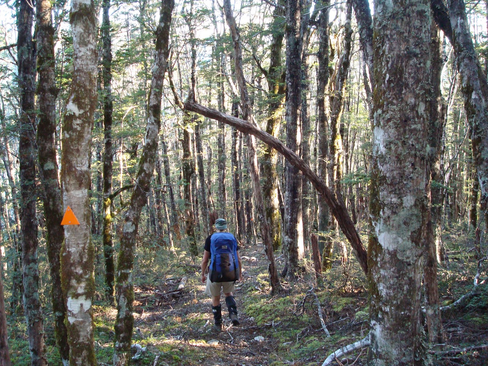


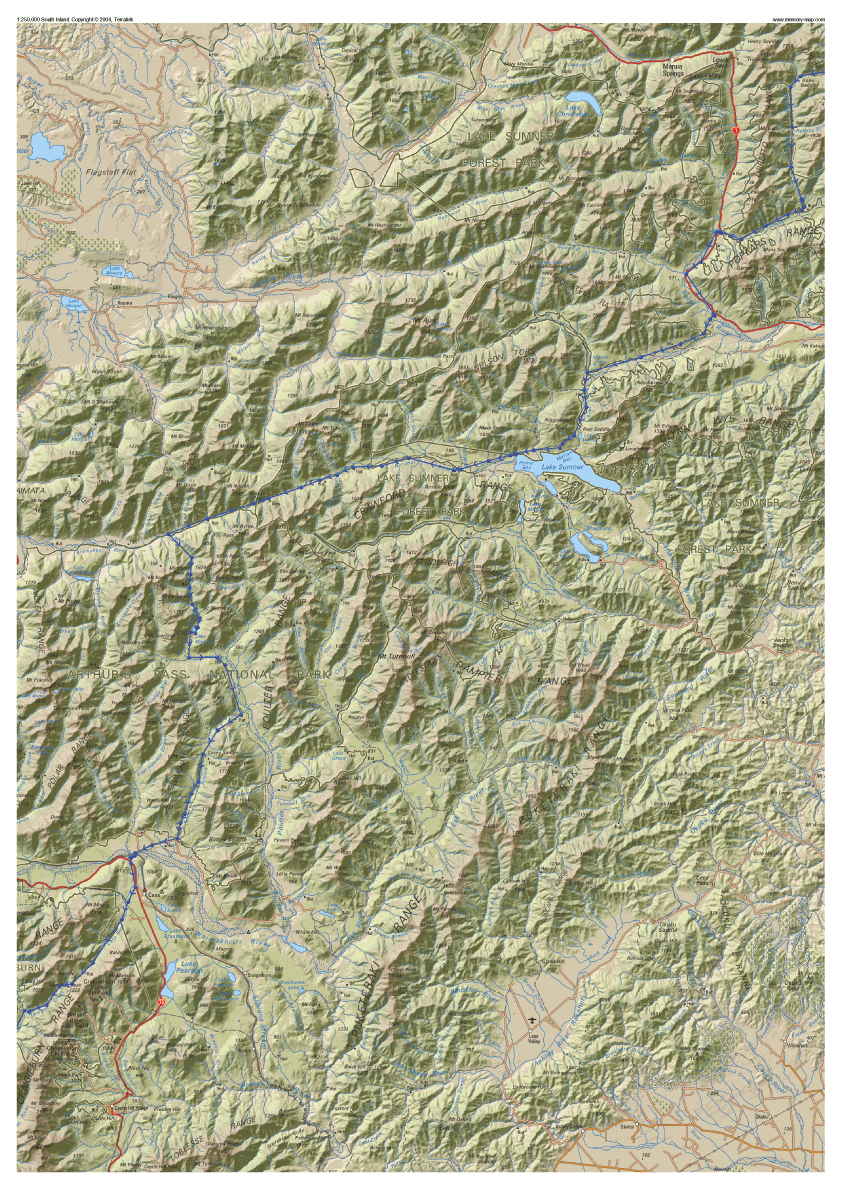

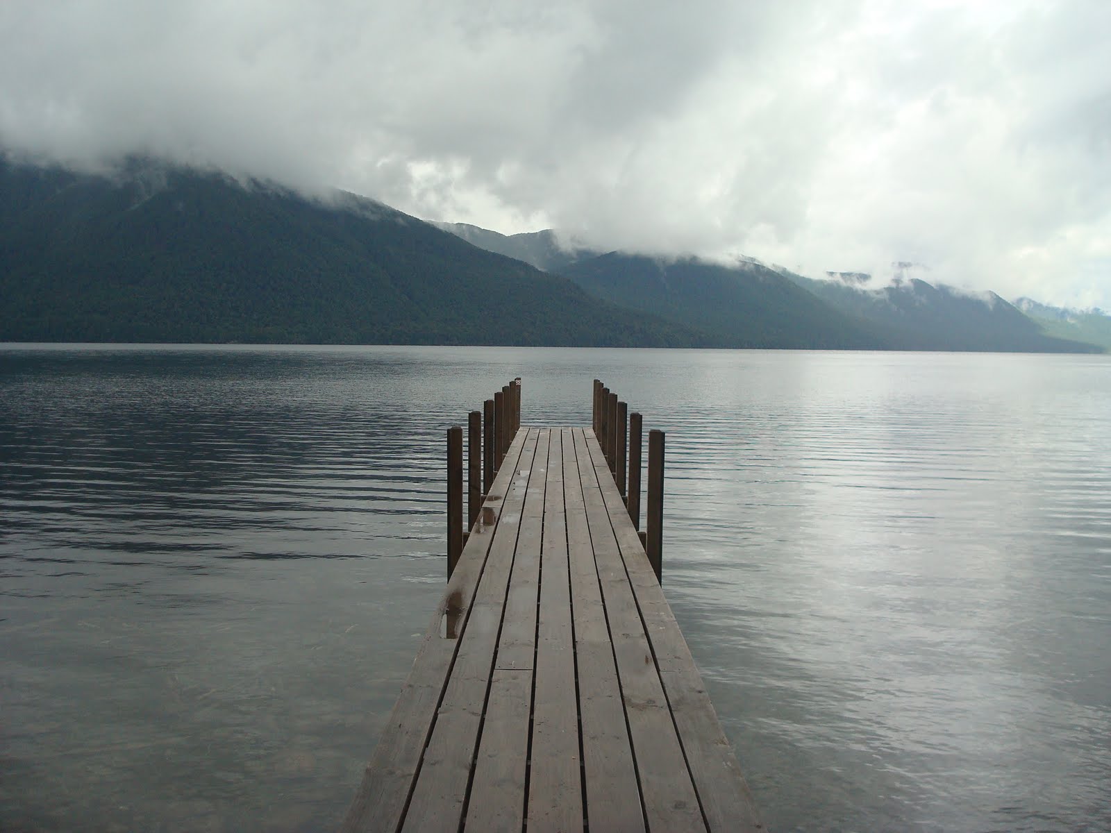


No comments:
Post a Comment